ALSO KNOWN AS CAMBRIDGE NAGIR EXPEDITION 1961 · CAMBRIDGE MINAPIN GLACIER EXPEDITION
In the summer of 1961 eight Cambridge undergraduates led by W. P. Gamble drove two long-wheelbase Land Rovers overland from England through Istanbul and eastern Turkey to Rawalpindi, then argued their way past the Pakistani authorities to take them over the 4,173 m Babusar Pass — a road built only for jeeps — to Gilgit, which Gamble called the only pioneering aspect of the trip. From Gilgit they went on by hired transport, donkey and porter up the Hunza valley to Minapin in the state of Nagir and spent a month to the end of August on glaciological and botanical work on the avalanche-fed Minapin Glacier under Rakaposhi, before driving home by Lahore, Isfahan and Istanbul.
THE HIMALAYAN JOURNAL ARTICLE NAMES ISTANBUL, EASTERN TURKEY, RAWALPINDI, THE BABUSAR PASS, GILGIT, MINAPIN AND CHALT OUTBOUND AND LAHORE, ISFAHAN AND ISTANBUL ON THE RETURN; THE LINE BETWEEN THEM FOLLOWS THE STANDARD OVERLAND ROAD OF THE PERIOD (THE IRANIAN CROSSING IS IMPLIED BY ISFAHAN AND BY GEOGRAPHY, NOT NAMED OUTBOUND). MONTHS ARE INFERRED FROM 'END OF AUGUST' AND THE INDEPENDENCE DAY VISIT; THE ARTICLE GIVES NO DATES. DASHED = RETURN LEG.
THE JOURNEY IN SIX MOMENTS
July 1961BosphorusTwo Land Rovers cross into Asia and the dust roads begin.July 1961Babusar PassLong-wheelbase Land Rovers argued over a jeep-only pass road to Gilgit.July 1961Gilgit to MinapinVehicles abandoned; three days up the Hunza valley by hired transport and on foot.14 August 1961Independence Day at ChaltEightsome Reel for the Mir of Nagir.31 August 1961Work ends on the glacierPlane-table map of the snout; plants to the British Museum, two new species.September 1961Home by Lahore, Isfahan and IstanbulReturn on the improved Babusar road.
12 WAYPOINTS · 4 COUNTRIES
DEPARTEDJune 1961 CambridgeARRIVEDSeptember 1961 EnglandDISTANCENo mileage is given in the source; London to Rawalpindi by the overland route of the period is roughly 10,000 km each way.
COUNTRIES CROSSED, IN ORDER
GBUnited KingdomTRTurkeyIRIranPKPakistan
The expedition
The expedition's object was to study the Minapin Glacier in the north-west Karakoram, which lies under the eastern shoulder of Rakaposhi and beneath the then-unclimbed Minapin Peak (Diran). The glacier is unusual in having no névé: it is fed all year by the collapse of cornices and ice cliffs from the ridge between Rakaposhi and Diran, and glaciologists suspected that such avalanche-nourished glaciers responded more sensitively to short-term climatic change. The British attempt on Diran in 1958 and a German one in 1959 had both used the Minapin valley as their access and their reports were the basis of the Cambridge plan. The snout, unusually low at about 8,500 ft, had by local report advanced about 200 yards in the previous year and had disrupted one of the irrigation channels on which the Hunza villages depend.
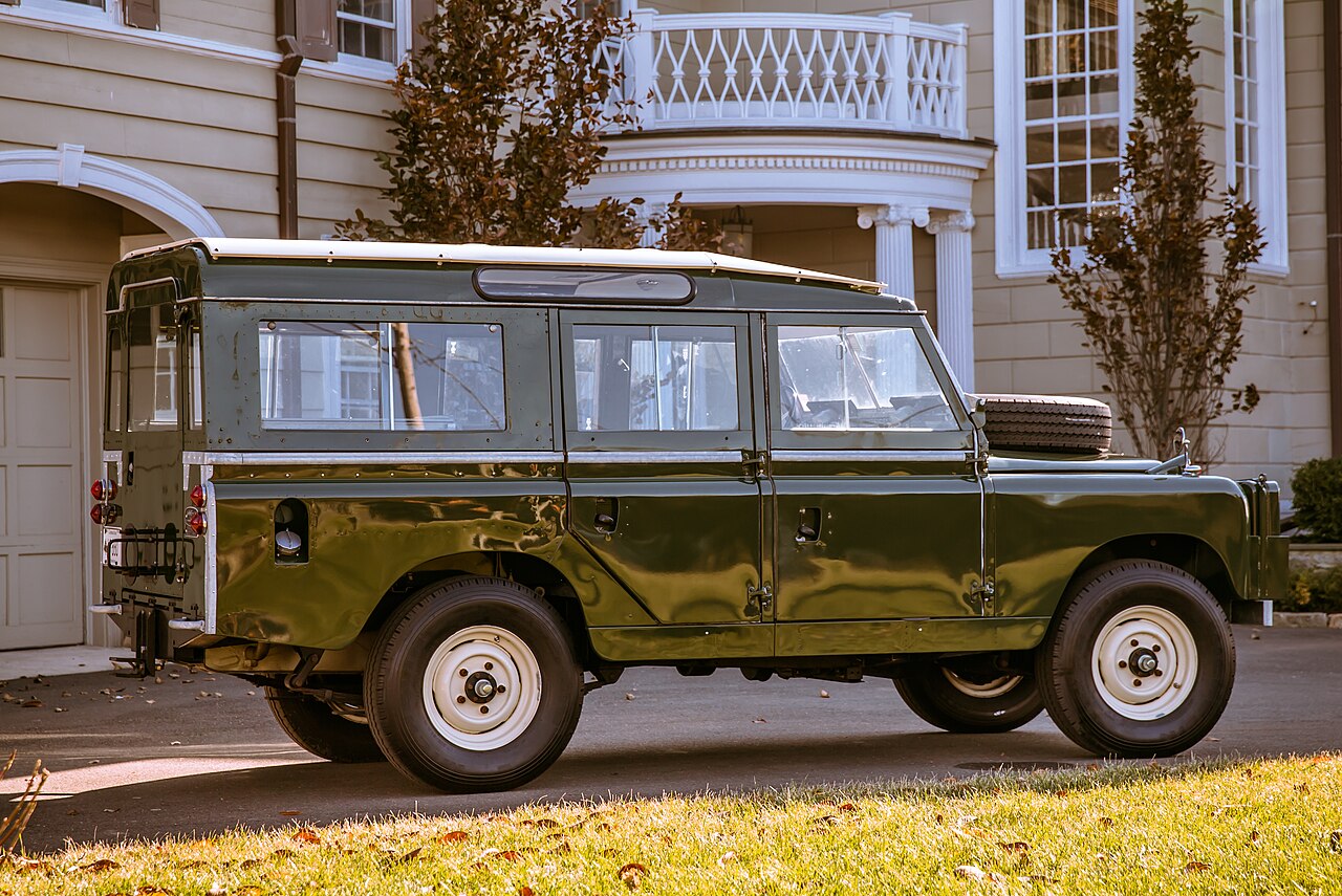
The party of eight travelled overland from England in two long-wheelbase Land Rovers, diagonally across Europe and over the Bosphorus at Istanbul into Asia, where the dust roads meant the second vehicle had to keep at least a quarter of a mile behind the first to see anything at all; a convoy of army lorries in eastern Turkey was the hardest thing to pass on the whole run to Rawalpindi. The only pioneering aspect of the trip, as Gamble put it, was the decision to enter Gilgit by driving over the Babusar Pass from the Kaghan Valley. The pass road had been built exclusively for jeeps and the long-wheelbase Land Rover was both bigger and heavier; a considerable amount of argument was needed to convince the authorities that it could take the sharp bends and steep gradients. The authorities gave way and the expedition reached Gilgit without mishap, though members had to make a few road modifications of their own, notably hacking away the side of a fallen boulder with tyre levers. By the time they came back the road had been improved out of all recognition, because President Ayub Khan was holidaying at Naran, the new tourist centre just south of the pass.
At Gilgit the Land Rovers had to be abandoned and the party went on by hired transport, donkey and porter, taking three days up the Hunza valley to Minapin, where apricots were in season and were pressed on them in wooden bowls. A week after leaving Rawalpindi they were organising porters at the Minapin rest house; the liaison officer coaxed and threatened them up to a base camp at about 10,000 ft, from which a smaller party worked the Upper Basin. The botanists collected in the ablation valley behind the lateral moraine at about 12,500 ft, particularly a Polygonum, and on two mountains; the plants went to the British Museum and two new species were later announced. The glaciologists worked the western end of the Upper Basin and the snout, where the expedition's surveyor made a plane-table map to compare with Hayden's of 1906, Mason's of 1913 and the German photogrammetric survey of 1959. A visit on horseback to the Mir of Nagir at Chalt for Independence Day ended with the eight dancing an Eightsome Reel by moonlight at his request. Work continued until the end of August; avalanches were constant and one upper camp had to be moved after rockfall.
The return was made by the improved Babusar road, then through Lahore, Isfahan and Istanbul. D. H. Macbryde's Scientific report of studies carried out on the Minapin Glacier by members of the Cambridge Expedition to Nagir, Karakoram, 1961 appeared in 1963. The article gives no registrations or further details of the two Land Rovers and their later fate is not recorded.